大地测量新技术应用及研发
Application and Development of New Geodesy Technology
研究内容:挖掘经典大地测量、空间大地测量高新技术,面向航天、高精尖测量工程等国家需求,开展大地测量新技术的工程化应用研究,包括GNSS数据处理软件开发、多模接收机研制、时间同步技术、GNSS连续运行参考站网络RTK技术、大型工程基础勘察、形变监测系统以及资源探勘等。
组长:刘根友
组员:郝晓光 阳仁贵
主要在研项目:
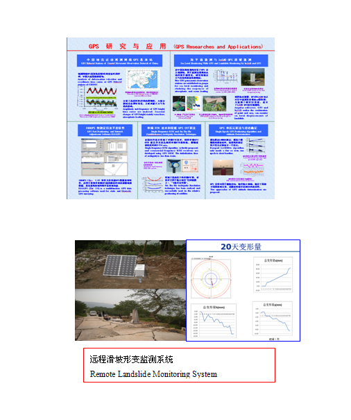
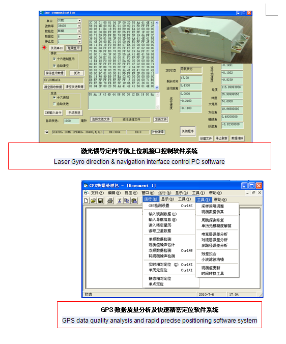
网络RTK数据处理及其软件开发
GPS 单历元定位算法及其在地学中的应用
飞船交会对接相对定位定速方法与软件研制
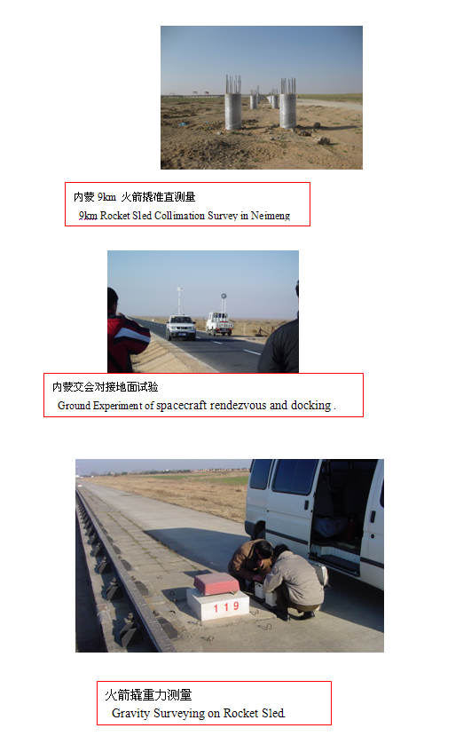
火箭撬准直方法与施工控制
重力卫星KBR时间同步方法与软件研制
北斗二代用户机随机软件的开发
Research contents: Mining high technologies of classical geodesy and space geodesy, facing to aerospace, defense, high top precise surveying engineering and other countries demand, to carry out geodetic engineering applications of new technology research. Including the GNSS data processing software development, multi-mode receiver development, time synchronization, GNSS Continuously Operating Reference Station Network RTK technology, basement investigating of large-scale projects, deformation monitoring systems, resources exploring and so on..
Chief: Liu GenYou
Members: Hao Xiaoguang, Yang Rengui
Main current projects:
Network RTK data process and software development
GPS single epoch positioning and its application in Geophysics.
Determining of relative position and velocity in spacecraft rendezvous and docking.
Rocket Sled collimation method and control survey.
Time synchronization method of KBR and software development in gravity satellites system.
Commercial software development of COMPASS II navigation system receivers.